🧭 Multiple Tremors in Inland Empire During Morning Hours
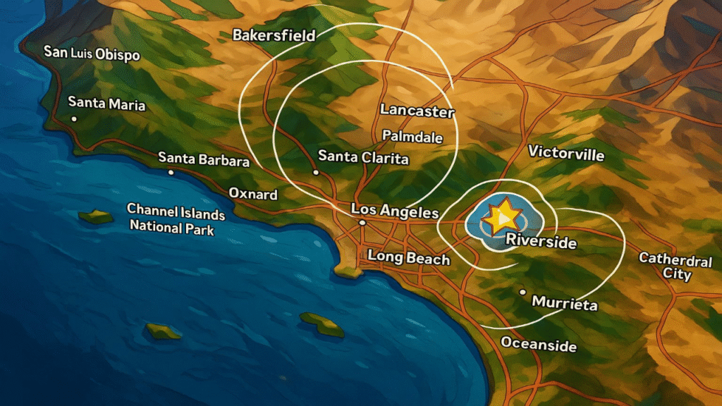
On Thursday morning, San Bernardino County residents experienced a series of early-morning tremors starting with a magnitude 3.0 quake near Rialto, followed minutes later by a 2.8 aftershock, and then a significant 4.4-magnitude earthquake around 9:32 a.m., just west of Muscoy. A further 4.3-magnitude quake struck shortly after near the same area. These events were felt across the Inland Empire, with shaking reaching Los Angeles, San Diego, and even parts of Riverside County.
🌐 Wide Coverage: SoCal and Beyond Felt the Shaking
Residents reported windows rattling and ceilings vibrating as far west as downtown Los Angeles and east into Coachella Valley. In Orange and San Diego Counties, people described sudden jolts as if a heavy truck passed close by. California’s seismic networks linked these tremors to the Fontana trend, a known cluster zone of small but frequent quakes .
⚙️ Earthquake Mechanics: What Made These Quakes Noticeable?
Two key factors contributed to the perceived intensity:
- Shallow depth, estimated between 5–6 km (3–4 miles), which allows tremors to travel farther and feel stronger.
- The region sits among multiple fault systems including the San Andreas Fault and the San Jacinto Fault Zone, which concentrates stress and causes occasional clustered quakes

Although these quakes were relatively moderate in magnitude, the timing and proximity made them clearly perceptible across densely populated metropolitan areas.
👥 Community Response: What Locals Experienced
- A Rialto resident described being jolted awake: “It felt like my frame bed was hit by something heavy.”
- In Long Beach, someone said: “I thought a truck rolled by felt it in my kitchen.”
Local fire and sheriff’s offices reported no injuries or structural damage, though emergency call volume spiked as residents sought peace of mind .
✋ Experts Weigh In: Precautions in a Seismically Active Region
From UCLA to USGS, seismologists stress that while magnitude-4 quakes aren’t unusual in the region, they serve as important reminders. Dr. Lucy Jones identified the pattern as part of a recurring cluster in the Fontana trend area .
Local emergency agencies recommend households:
- Secure heavy furniture and appliances.
- Prepare an emergency kit including water, medications, cash, and flashlights for at least 72 hours.
- Practice earthquake drills Drop, Cover, and Hold On to reduce risk during tremors
Schools and community centers across Southern California have resumed earthquake preparedness events after slight lulls, emphasizing readiness for when a larger seismic event strikes.

📌 Historic Context: Notable Past Quakes in the Region
- The 1992 Big Bear-event and Landers sequence caused major geological disruption: collapsed chimneys, surface ruptures, and over 400 injuries. The area saw wide structural damage but no fatalities within SoCal urban cores
- The southern branch of the San Jacinto Fault Zone, running through San Bernardino County, is known as the state’s most active fault system even more probable than the San Andreas to produce mid-sized earthquakes in the coming years.
These events remind residents: Moderate quakes today may foreshadow larger events tomorrow.
🏘️ Risk Factors in San Bernardino Community
San Bernardino County has nearly 89% chance of a magnitude 5.0 quake over the next 50 years. Urban density, older housing, and high levels of socioeconomic vulnerability heighten impact. About 34% of residents live in poverty, and communities speak multiple languages posing challenges for disaster messaging and coordination
Local city emergency planning departments are drafting hazard mitigation plans to prepare vulnerable populations and infrastructure for future seismic events.
✅ What You Should Do Next
| Action | Description |
|---|---|
| Secure household items | Fasten bookshelves, TVs, and tall furniture |
| Build a go-bag | Store 72-hour supply of essentials (water, meds, cash) |
| Practice drill | Express habit of Drop, Cover, Hold On |
| Stay informed | Download ShakeAlert or NOAA warning apps |
| Check local plans | Understand evacuation routes and shelters |
🧷 Final Thoughts
The multiple 4.4 and 4.3 magnitude quakes that rattled Southern California this morning serve as a stark reminder: the region remains an earthquake hot zone. While damage was minimal, public reaction and expert input underscore the need for continued vigilance.
From city council buildings to family homes, preparedness is not optional it’s essential. Whether it’s earthquake straps on bookshelves or your 72-hour emergency bag, be ready.
Stay connected with TrendScoop360 for more updates on this story and other trending news across the United States and the world.

